The Met Office has issued a Yellow Warning for heavy rain covering Somerset from 10pm on Friday to midday on Saturday.
The forecaster says the expected downpours will bring "some flooding and disruption."
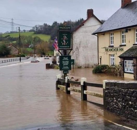
The next downpour comes on top of several days of rain in Somerset which triggered a series of flood alerts and warnings.
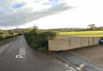
On Thursday, flooding closed minor roads around Wellington and Dulverton, with rivers across the area at high levels. There were reports of properties being flooded in the Withypool area.


The Friday night warning from Met Office is warning people to expect:
Homes and businesses could be flooded, causing damage to some buildings;
Delays or cancellations to train and bus services are possible;
Spray and flooding could lead to difficult driving conditions and some road closures;
Some communities may be cut off by flooded roads;
Possible power cuts and loss of other services to some homes and businesses.
Yellow Weather Warning for heavy rain
Flood alerts and warnings were issued and updated across Somerset and East Devon ahead of the expected heavy rain.
Flood Warnings
A series of second level flood warnings issued by the Environment Agency were in place in West Somerset on Friday, advising people to act now as flooding is expected.
Washford River, riverside properties from Kingsbridge to Lower Roadwater
Flood warning area: Riverside properties from Kingsbridge to Lower Roadwater including riverside properties in Kingsbridge, New mill, Langridge Mills and riverside properties in upper Roadwater and lower Roadwater.
River Exe from Exebridge to Tiverton
Flood warning area: Riverside locations and roads between Exebridge and Tiverton, including Exebridge, Oakford Bridge, Chain Bridge, Cove, Washfield, vulnerable parts of Bolham, the B3226 at Black Cat and the A396 at Bolham.
Flood Alerts
First Level flood alerts were also issued, advising people to be prepared for possible flooding.
River Tone catchment between Wellington and Taunton
Flood alert area: River Tone from Clatworthy Reservoir to Currymoor, the Hillfarrance Brook, the Halsewater Stream and other tributaries in the River Tone catchment.
West Somerset Streams
Flood alert area: Horner Water, Rivers Aller and Washford, and the Hawkcombe, Monksilver and Doniford Streams and tributaries.
Somerset Coast at Porlock Weir
Flood alert area: Coastline between Gore Point and Hurlstone Point including Porlock Weir.
Exmoor Rivers
Flood alert area: the Upper River Exe from Exford to Exebridge, the Rivers Barle, Lyn, Mole and Bray and their tributaries, and coastal streams from Combe Martin to Lynton.
Middle Exe Area
Flood alert area: Middle River Exe from Exebridge to Tiverton and the Rivers Haddeo, Batherm and Lowman.