
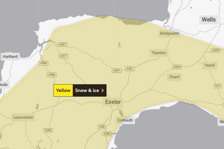
The Met Office has issued a fresh warning for snow and ice covering parts of Somerset on Tuesday night.
The Yellow Warning runs from 6pm to 10am on Wednesday with wintry showers forecast across the region.
The Exeter-based forecaster predicts snow and ice could cause travel disruption over a large part of the Westcountry, including Exmoor and the lower ground around Wellington.
It says: "Some roads and railways likely to be affected, leading to longer journey times by car, as well as bus and train services.


"Snow and sleet falling on frozen surfaces may lead to icy conditions, increasing the risk of accidents and injuries.
"The combination of wind and snow may cause some drifting and very poor visibilities, especially over hills and moors."
The latest warning follows weekend snow showers which covered roads on the high ground of Exmoor, and led to snow flurries in Wellington.
The temperatures will drop below freezing across the region again overnight and there is a risk of snow showers in the early hours of Wednesday morning.
The cold snap is due to continue with sub-zero temperatures until the weekend, when the weather is expected to warm up.