A COLLECTION of maps of Wellington and the surrounding area dating to the early 19th century will be on show in the town council’s Pop Up Shop on Saturday (September 21).
Wellington Local History and Museum Society has more than 50 maps in its archives but does not have enough room to display them all in its premises opposite the Pop Up Shop in Fore Street.
So, once a year, it puts many of them on display for public viewing.
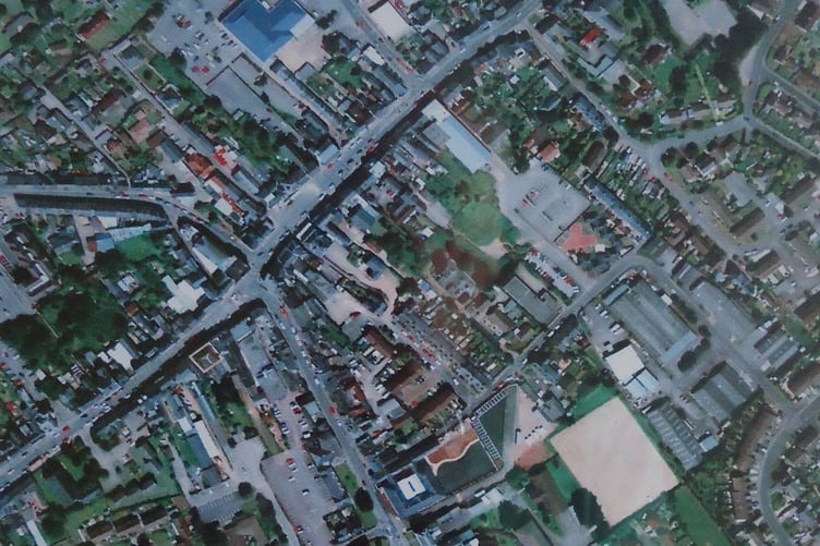
The maps and some 20th century aerial photographs which will also be on display, show the town’s development from the early 19th century to the present day


The free to attend exhibition will run from 10am to 12noon.
Among the items on display will be an 1887 town centre map at a scale of 1:500, the entire urban area mapped in 1887 at a scale of 1:2500, and 1920 maps of Langford Budville, Nynehead, and Sampford Arundel.
There will also be a Somerset map circa 1809, a page from Ogilby’s 1675 road atlas showing the route from Bristol to Exeter via Wellington, which is the present-day A38, and several 1930s aerial views of east Wellington.
Comments
This article has no comments yet. Be the first to leave a comment.